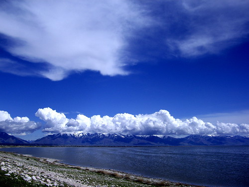
Stratocumulus clouds are known for their puffiness and tendency to spread out and break into waves, sheets, rolls, and lines. They are the type of clouds that have holes, rows and spaces where blue skies can translucently or transparently be seen.

They display the combination of the characteristics of stratus and cumulus: the former is wispy and made of thin sheets, while the latter creates a puffy, cotton wool resemblance.
Stratocumulus clouds can only reach low latitudes, with an estimate average of 4,000 to 8,000 feet above the surface. Stratocumulus clouds are products of the exchange between fronts of cool and moist air and dry and warm air.
Many people regard them as the clouds after the storm, and the symbols of a bright day. Precipitation wise, these clouds can only bring gentle rain and light snow.
Stratocumulus clouds are common among countries with subtropical and polar environment, as it is in these regions where meetings of warm and cold air dramatically happen.
Stratocumulus clouds must not only be seen as gray, low clouds waiting to be turned into rain clouds. They are agents that affect humidity and temperature on earth’s surface. These clouds participate in controlling low and high land temperatures during the peak of seasons, reducing the heat during summer and reducing the cold during winter.